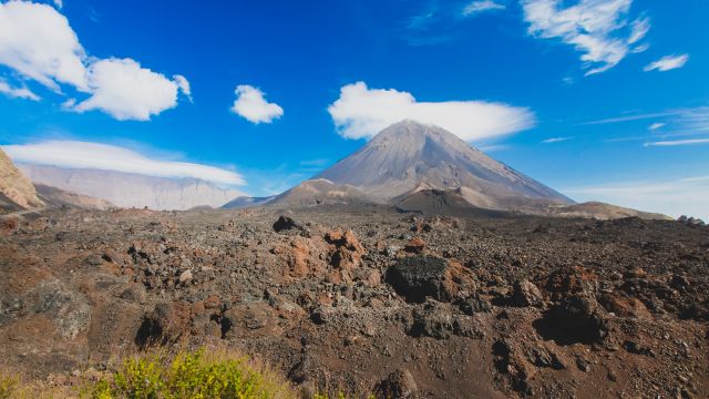
Average weather for Fogo in September
It's warm in September in Fogo with an average temperature of 29°C. Temperatures this month range from a low of 29°C to a high of 31°C. At night, you can expect temperatures between 25°C and 26°C.
Start of September
The month of September starts in Fogo with hot temps, averaging around 30°C during the day and nights around 26°C. You can expect regular precipitation, but there will also be some sunny days in the early part of the month. Light clothing like shorts or a dress, and a hat and sunglasses are perfect.
Mid September
By mid-September, daytime temps stay steady at around 30°C, with nights around 26°C. There’s a chance of some showers during this time, but plenty of dry and sunny days too. Light clothing like shorts or a dress, and a hat and sunglasses are perfect.
End of September
By the end of September, the average daytime temperature in Fogo is around 30°C, while nighttime temps are about 26°C. A shower might pop up, but overall, the weather will be dry and sunny. Light clothing like shorts or a dress, and a hat and sunglasses are perfect.
In September, there is an average of 91 mm of precipitation, spread over 12 days. The wind speed is around 4 Bft, mostly coming from the East.
Fogo in September |
New York | ||
|---|---|---|---|
| 29°C | 27°C | ||
| 31°C | 31°C | ||
| 29°C | -5°C | ||
| 91 mm | 57 mm | ||
| 12 days | 9 days | ||
UV index
The UV index is a maximum of 9 this month. That's a very high value on the intensity scale of 1 to 11. Unprotected skin can burn within 10-15 minutes.
Is September a good time to visit Fogo?
Looking for great weather? September is a good time to be in Fogo. The temperatures are nice, and there’s not too much rain.
Temperature records
With 45°C in 2014, Fogo reached the highest temperature in September over the past 10 years. The lowest daytime temperature in this month was 23°C in 2023. The extreme nighttime temperatures ranged from a lowest recorded value of 22°C to a highest value of 27°C.
Check out the climate of Fogo for all months and discover the best travel time
Daily Temperature in September in Fogo
This chart shows the average daily high and low temperatures in September for Fogo, in degrees Celsius. The red line represents the highs, and the blue line shows the lows. The days of the month are displayed at the bottom of the chart. The data, based on historical observations, provide the average temperatures for this month.
Daily Precipitation in September in Fogo
The chart below shows the average daily precipitation in September for Fogo, measured in millimeters over the past few years. Precipitation is always measured as water, even if it’s snow or hail. The days of the month are listed at the bottom of the chart.
A low average precipitation means that the chance of rain on that day is usually small, while a higher average suggests that it rained more often. But remember, it’s just an average, and every day can be different. Based on historical weather data for September, you can expect about 12 days of precipitation in Fogo.
Daily UV index in September in Fogo
This chart shows the average daily UV index in September in Fogo, with the UV index ranging from 0 to a maximum of 11. The bottom of the chart shows the days of the month. Based on historical data, this chart provides an idea of the daily UV radiation levels you can expect.
Temperature in September in Fogo over the years
This chart shows the average temperature in September in Fogo, measured in degrees Celsius, over the past few years.
Total precipitation in September in Fogo over the years
This chart shows the average precipitation in September in Fogo, measured in millimeters over the past years. Precipitation is always measured as water, whether it’s snow or hail.
Daily weather in September for Fogo
Click on any day in September to get detailed info about the usual weather on that day in Fogo. Check out the historical temperatures and precipitation over the past 10 years on this day.


Weather experiences in September in Fogo
Have you been to Fogo in September?
Share your weather experience in September in Fogo.
Average weather in Fogo by month
Click on a month below to see detailed weather info for Fogo. Based on historical weather data, you can see the average temperature, precipitation, wind, and UV index for each day of the month.
